Posts

Showing posts from 2016

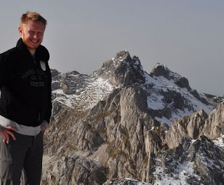
Trpezarija (from Zurim) 2,040m

Image
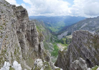
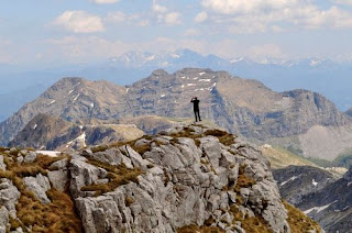
This ridge, the second parallel ridge going northwards after passing Zurim, has featured in many of my hikes this year. However, so far we have either gone eastwards along the top of the ridge, or perpendicular across it towards the next ridge (Mt Lola). This time we decided to go westwards along the top of the ridge towards Bijela and Krnovo. It took about two hours to get from the car parked by Zagaracki katun to the top of the ridge, then another hour or so to the highest point of the peak Trpezarija, not far from where the wind farm on Krnovo starts. It was not a tough walk, but we had to be careful because of the early sunset this late in the year. We wanted to see whether there was a quick route down from the ridge to the valley bottom, but not finding one along the way, we had to return the way we came.

Sljeme on one of the shortest days

Image
More just for the exercise than anything else, we decided to head over to Durmitor and enjoy the view from the top over all of Durmitor National Park. We needed crampons near the top, as the peak was covered in ice and packed snow. We tried exploring the minor peaks between Sljeme and Bandijerna, but decided that we would be hard-pressed for time and so headed down. The descent took a little longer than we had bargained for, and ended up seeing the sun set as we came down and returned to the car with hardly any light left.

Veliki Zurim in fog

We set out on a cloudy day, hoping that the road would not be covered in snow or ice, and we were fortunately able to get to the katun at the foot of Mali Zurim. A view from Borovnik a week earlier had revealed another way up Veliki Zurim, and it was decided to explore this, even though the entire mountain was engulfed in low cloud and we could not see where our path was taking us to. When we found an animal trail, we followed it up a snaking route to a pass, but given the limited visibility, headed straight up to where we knew the summit to be, which was marked by a canister containing a log book and pen. The way down was potentially dangerous, given that we could not see that far in front, but I trusted to my memory of climbing it before, and we managed to descend without problem, if a little tentatively.

Mt Borovnik (from Zurim side)

Image
Ice on the road to Zagoricki katun prevented us from driving up to the foot of Zurim, so we decided to head towards Borovnik, which I still have not climbed right to the top. There was some snow on the ground and the rivulets that crisscross the Lukavica valley were apparently in full flow. We had to cross on stepping stones on many occasions, until unexpectedly we came to a beautiful hidden waterfall. I managed to divine a way up this side of Borovnik, up a grassy strip cutting through boulders and pine trees. This side was relatively free of snow, facing towards the sun, but once we got to the top, there was enough snow to hide the crevasses and cracks in the rock, and made traversing the top ridge quite hazardous. But the weather was excellent and the descent was relatively danger-free. Borovnik is a wide massif, and the three times I have tried to climb it, there has not been enough time to get from the foot right to the summit

Autumn walk in the (national) park - Biogradska gora

Image
This is not strictly a hike, more like a long drive and mini-walk. But autumn in this national park is spectacular because of the diversity of trees and the colours of the leaves. Every day gives you a different combination of sunlight, clouds and foliage, and I was on this occasion treated to strong winds which suddenly blew a cloud of leaves over the lake, as if caught in a locust swarm. The entrance fee to the national park is €3 and it is accessible from the main Podgorica-Bijelo Polje road, north of Kolasin. Construction is ongoing on a restaurant (if was ongoing last year at the same time) by the lake, and the souvenir shop was closed

Bandijerna Peak (2,409m)

Image
Four weeks after the last attempt was thwarted by rain, I finally returned to this peak, close to Durmitor's highest (Bobotov kuk) and right in between the jagged edge of Zupci and Sljeme. Despite being higher than Prutas, the walk to this peak is relatively short from the parking area at Sedlo, on the Virak-Trsa road. There was still snow on the north-facing and shaded spots, but nothing too concerning. The path was very muddy and slippery from the thawing snow, but once we got off the path onto the rocks the going was easier. There is no marked path except the path to Zeleni Vir and Bobotov kuk, but, as visibility was good this time, we were able to veer off and head towards Trojni prevoj (Three-way Pass). It seems there are piled stones on some of the rocks to indicate roughly the right way, but it was no problem just heading towards where I knew we had to go. From Trojni prevoj we headed straight up the mountain from where we were rewarded with a beautiful 360 degr

Šarena Lastva (nr. Mt. Maglić) 2228m

Image
I had been planning for the whole year, and in fact for the last 13 years to do a hike to Lake Trnovac in the Piva region. It seemed like the days were getting too short to be able to do such an epic hike, but we set off from Nikšić early in the morning towards the village of Mratinje. Despite my usually trusty car temporarily conking out on the way, we made it as far as we could go along the macadam road past Mratinje to a village I think is called Čair or Ćalasani. After some helpful advice from a friendly local, we followed the clear trail markers from the low cloud and autumnal colours, eventually through the mist and above the clouds and into snow, which had fallen the previous day. With frequent digging to find the buried markers, we made our way ever upwards, mindful of the need to get back before dusk. At one point we realised that uncovering the trail markers was using up valuable time, so we headed towards what seemed to be a promising peak through 20cm of snow,

Mrtvica Canyon (slightly amended route)

Image
Firstly, just to say that I haven't included a picture of the more famous parts of the actual canyon, because this is about my tenth time to hike it and so I didn't take many photos. What was different this time is that we took a route that went on the left side of the river, rather than the more usual right bank. The starting point is about 40 minutes north of Podgorica on the main road to Kolasin. There is one asphalt road with signposts for Mrtvica Canyon and the village of Mrtvo Duboko, but we took the road leading to the village of Velje Duboko and parked almost immediately. One path leads across an iron bridge where we joined the asphalt road towards the village of Mrtvo Duboko, past several beautifully constructed houses, then down to a bridge made of thin planks, and further on to the bridge pictured above. Then we joined the familiar path along the canyon itself. For those reading who have never seen the canyon, it is breathtaking in its proportions. It is

Tićjak/Božurni vrh (1,900m) Mala Lukavica

Image
With the desire to do some bouldering and perhaps get an interesting angle on Lake Kapetanovo, we drove to St Elijah's Church on Lukavica and decided to clamber up the hills/mountains on the right, instead of the left. I don't know whether these are part of Maganik, Zurim or neither, but they resemble Maganik by the rock formations - lots of bare karst, etched by water into picturesque shapes, but always characterised by smooth faces and knife edges. The ascent was not difficult, but we often fell through what seemed to be grass or shrubs in between rocks, but which just covered over a deeper void. I sustained bruising and scratching from one such fall. However, the view over the plain of Lukavica, combined with a panorama of Maganik on the other side and with the Mrtvica Canyon snaking away into the distance towards the Kom Mountains and Prokletije range, make this central part of Montenegro particularly beautiful, in a harsh, rocky way.

In search of a lake / Mt Lola

Image
The previous time I had walked to the "Third Ridge" my idea had been firstly to see how far we could get in a day, and secondly to try to find a small lake I had espied from an Air Serbia plane flying overhead from Podgorica to Belgrade. Although I had my usual morning work until 10.30, we arrived at Zagoricki katun by Zurim at around 11.30 and picked a slightly different route over the first two ridges. This involved picking the most dangerous, but doable routes up the cliff face. We got to the point we had ended up before and decided to press on further to see what was over the next horizon. It was then that we stumbled across a couple of natural arches eroded out of the mountainside, and from there we could also see the "lake" far below us (although it was hard to determine whether there was actually any water in it). On the way back we tried another new route straight up the second ridge, but I was starting to suffer from heatstroke and couldn't

Zupci in the rain

Image
Usually, the weather is fairly predictable and as such we usually skip rainy weekends. However, I was desperate to get out into the mountains on a day which was supposed to be OK in Durmitor, but terrible anywhere more south. As it turned out, we weren't quite north enough and so the highlands were engulfed in cloud and rain. The idea was to go from Sedlo to the peak of Bandijerna, but the lack of visibility made it unwise to stray from the clearly signposted path to Bobotov kuk. So we ended up at Zeleni vir and nowhere along the walk did we get any view of the surrounding mountains, except for 10 seconds on the way back when the clouds momentarily parted. Of course, as soon as we got back to the car, it was beautifully sunny.

Mt. Borovnik, from Vucje

Image
Despite making a couple of attempts in the snow to reach the top of Borovnik, and despite never quite seeing it as a pretty enough mountain to climb when other options are available, I decided to find out how long it would take to climb it from the ski centre at Vucje . Since the road to Vucje is regularly cleared of snow in the winter, the ski centre is an ideal place to start hikes when nowhere else is accessible. The walk from the top of Vucje to the foot of Borovnik is quite flat, although in order to avoid private property we had to divert over some rocky outcrops, which slowed us down. It took over two hours to get to under Borovnik, but then the climb was interesting, not least because of the mix of karst crisscrossed with fractures and trees/bushes. We didn't manage to get to the very top, as we wouldn't have had time, but the descent was interesting, as I chose a 'route' down which from a distance looked like a sheer drop, and was not for the fain

Ranisava, Durmitor

Image
This was another hike borne out of the sentiment "That mountain looks interesting, I wonder how we could climb it". We parked along the road to Trsa, where there is signpost for walks to Modro jezero. The mountain itself has no hiking trails, but there are cattle trails up the first part. It had rained just before we attempted this climb, and with thick ground vegetation, our lower legs and feet got soaked very quickly. It was also misty when we started climbing, and it wasn't until we were half-way up that the cloud lifted. The views were amazing, and finding a route was an interesting exercise, but we made it to the first peak, and despite some precarious crawling along the top of a ridge (which eventually becomes Sedlena greda) we made it to the highest peak of Ranisava. Coming down, we decided to take a short cut, which as it usually does, turned out to be not as easy as it looked. We had to navigate our way down over movable rock, where any dislodged mat

Mt Lola, or 'the Third Ridge'

Image
I had one last hiking opportunity before going back to the UK for a family holiday. In a desire to further explore the Moraca Mountains, and to find a body of water I had spotted when flying over the area en route to Belgrade, we decided to attempt to reach the third ridge from Zurim. The second ridge is called Stit, and we had climbed this a few months back. We had walked along the foot of this ridge on our way to the Kapa Moracka waterfall. This was to be an endurance test to see just how far we could get in one day. It turned out to be less demanding than the Kapa Moracka hike (because of the extreme ascent), but gave us great views towards Sinjajevina and the rest of Mt Lola, which I had hiked over a year before.

Babin zub/Torna - second (unsuccessful) attempt to climb

Image
With the information gleaned from the previous hike we drove as far as we could get along the macadam/dirt road, and set about looking for an animal track described in the guide book. Failing to find such a thing, we picked a possible route and scrambled up as far as we could safely get. There was some sort of sheep trail, but it was rather dangerous for humans and my companion did not wish to go back the same way. So we climbed down a rockfall which was very movable and eventually got back down to the road. Subsequent examination of satellite photograph has not definitively shown us where the route suggested by the guide might be, but if we ever try it again, we have some ideas. The simplest way would be to drive to the other side of the mountain to the village of Lipovac, where there is a signposted trail, but that wouldn't have been so fun. This face of the mountain is one of the most inhospitable areas of the country I have tried to hike in, but is an interesting s

Djedov do - first attempt to climb Babin zub/Torna (Sinjajevina)

Image
After climbing several of the peaks of the Moraca Mountains, our attention was turned towards Sinjajevina and particularly Babin zub a.k.a. Torna, on the opposite side of the Savnik-Kolasin road. This was to be our first exploratory hike in the area, and we parked along the main road and walked up along a macadam road which the guide book had talked about. This happened to be the hottest day of the year (or at least it seemed) and after 3 hours, we stopped for lunch, exhausted and running out of water, but without definitively finding a path up the mountain, but with ideas of where to look next time. The mountain is almost bare karst, like Maganik: completely different feel to the other Moraca Mountains which we could constantly see when we turned our backs on Babin zub.

Leading teenage group to Ice Cave

Image
I was a bit doubtful when I was asked to lead this group as whether they would all make it, as most of the participants had never been on a mountain before and were wearing All Stars. However, the majority soldiered on and made me proud. And despite one person twisting their ankle right at the top and having to be led down very slowly, we made it back to the start just before sundown. Every time I go to the ice cave, I remind myself that it looks prettiest in the spring when the ice sculptures are untouched and unmelted.

Sljeme climb (in summer weather)

Image
Unfortunately sometimes you arrange to be free on a particular day and the weather turns against you. Retracing our steps from our snowy and windy hike earlier in the year, we made it to the top without too much difficulty, but the very top of the peak was in cloud, so there were none of the great views of Medjed and Bobtov kuk. And then it started to rain as we made our way down to the car. Nonetheless, it was a good workout and our signatures were put in the summit book

Kapa Moračka waterfall

Image
This hike turned out to be unexpectedly physically demanding, although we allowed 9 hours for it, and returned to the car as the sky was darkening. We followed the path from the previous hike along Štit but instead of walking along the ridge we descended into the next valley and followed the valley floor to under the peaks of Lastva, Zagradac and Kapa Moračka, where we reached the waterfall after 4 hours of walking. The questionable decision was taken then to climb up a steep slope largely of scree which turned out to be around 500 metres high, which was pretty demanding and took us two hours along, with no small peril from sliding rocks. However, the view from the top of Štit was worth the exhaustion, but we still had to hurry back to the car to avoid being caught in the dark on the mountain. This hike was tough on the knees, ankles and feet, and I appreciated the fact that I had kept some level of fitness up over the spring.

Expedition into the Morača heartland

Image
After another week of torrential storms, we ventured out on a day which looked promising until the mid-afternoon. So we started at 6.30 and headed to the katun under Žurim, where we headed northwards past the ridge of Veliki and Mali Žurim towards the ridge of Štit, which involved much ascending and descending. When we reached the ridge of Štit, the massif of Lola was visible towards the north-west, and Kapa Moračka to the east. We turned eastwards and followed the top of the ridge to view the same region we had reached in the previous post/hike. This time the waterfall we had heard was clearly visible albeit from quite a distance below us. Our lunch was consumed precariously perched at the top of a sheer drop of roughly 500m. The return was not demanding, and offered the tantalising possibility that we could reach the waterfall next time.

Start of (non-snow) hiking season

Image
After a strange winter without much snow, we had a spring with too much snow and too much rain. Hence the hiking season started late, but with a vengeance! Having already climbed Zagradac two years ago, we thought we would set the ball rolling by climbing Lastva, a mountain almost immediately next to it, with a view to checking out some of the other peaks in the vicinity. My veteran VW Golf heroically made it as far as Lake Kapetanovo and we walked the rest of the way. It was quite demanding in areas because we took a steep path to the top, but the walk down was very leisurely. The view from the top was quite breathtaking because there were almost sheer cliffs that looked over a stony, bowl-like depression surrounded by a ring of mountains, Kapa Moracka, with two ridges perpendicular (Štit and Lola). We could also hear running water from a waterfall, but could not see it. Cue another expedition...

Stozina / Unsuccessful ascent of Sljeme

Image
This was an aborted attempt to climb Šljeme a few days after a more than a foot of snow had fallen. The road from Virak to Trsa was completely snowed under, so we parked by the main road, opposite the first turn-off to Trsa (by the road that leads down to Pošćensko Lake). This meant an extra kilometre above what we had walked along the road on 27 Feb, but also there was much more snow, so we had to snowshoe the whole time. We left the road just before Stožina and skirted around the depression next to it (on the opposite side from the road) amid worsening conditions due to low cloud. At times visibility was down to 100 metres, plus the uniform white of the snow made it very hard to judge distance and surface contours. In places we were creeping along using our walking poles to feel the surface a metre in front of us, afraid that there would be a sharp fall. A few times we fell over due to not seeing the edge of a snowdrift. The decision was made to not climb Šljeme but to

Mt. Stožina in the snow (1,905 m)

Image
The winter has been very mild even in Žabljak, such that the first kilometre of the ring road around Durmitor from the turn-off from the main road to Sedlo was open to cars. The walk from Pošćenski kraj to Sedlo is not very long, so the decision was made to try to climb Stožina, a dramatic-looking hill right next to the road that I had climbed during the late spring of 2015. Once off the road, the snow was quite deep in parts where it had drifted, but still rocks protruded in places. The climb was too steep for snowshoes, but crampons were perfect for the consistency of snow. Much of the hill is grassy terrain, so there was good grip almost all the way up. There was one tricky part two thirds of the way up, where it was very steep and there were many rocks, so in places the crampons were not helpful, in others the snow was very deep in between rocks and we were up past our knees in snow drifts. It took just over an hour to climb, but at the top the wind was bitter, snow s

Borovnik hike (1,930m)

Image
The road from Nikšić to Bare Bojovića, the area in front of Mts. Žurim, is notoriously blocked by snowdrifts until April most years. However, one can often get as far as the start of the Konjsko plateau (which is also accessible by foot from Vučje ski centre). As the winter had been very mild, we managed to get to this point (although we spent about an hour digging the jeep out of snow) and set off on snowshoes for Mt. Borovnik. The snow was very deep and even with snowshoes it was quite tough going, especially on the steeper sections. We ultimately didn’t have enough time to reach the main peak (because of getting the car stuck in snow) and were able to descend without snowshoes, by clambering over exposed rock and wading through the areas of snow where we had climbed up. The vista from the top was beautiful, as it contained the plateau that we had crossed, the Krnovo plain across which we had views towards Mt. Vojnik, with the peaks of Durmitor glistening in the distanc