Posts

Start of (non-snow) hiking season
Image
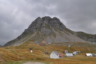
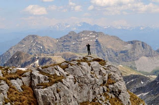
After a strange winter without much snow, we had a spring with too much snow and too much rain. Hence the hiking season started late, but with a vengeance! Having already climbed Zagradac two years ago, we thought we would set the ball rolling by climbing Lastva, a mountain almost immediately next to it, with a view to checking out some of the other peaks in the vicinity. My veteran VW Golf heroically made it as far as Lake Kapetanovo and we walked the rest of the way. It was quite demanding in areas because we took a steep path to the top, but the walk down was very leisurely. The view from the top was quite breathtaking because there were almost sheer cliffs that looked over a stony, bowl-like depression surrounded by a ring of mountains, Kapa Moracka, with two ridges perpendicular (Štit and Lola). We could also hear running water from a waterfall, but could not see it. Cue another expedition...
Stozina / Unsuccessful ascent of Sljeme

Image
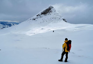
This was an aborted attempt to climb Šljeme a few days after a more than a foot of snow had fallen. The road from Virak to Trsa was completely snowed under, so we parked by the main road, opposite the first turn-off to Trsa (by the road that leads down to Pošćensko Lake). This meant an extra kilometre above what we had walked along the road on 27 Feb, but also there was much more snow, so we had to snowshoe the whole time. We left the road just before Stožina and skirted around the depression next to it (on the opposite side from the road) amid worsening conditions due to low cloud. At times visibility was down to 100 metres, plus the uniform white of the snow made it very hard to judge distance and surface contours. In places we were creeping along using our walking poles to feel the surface a metre in front of us, afraid that there would be a sharp fall. A few times we fell over due to not seeing the edge of a snowdrift. The decision was made to not climb Šljeme but to ...

Mt. Stožina in the snow (1,905 m)

Image
The winter has been very mild even in Žabljak, such that the first kilometre of the ring road around Durmitor from the turn-off from the main road to Sedlo was open to cars. The walk from Pošćenski kraj to Sedlo is not very long, so the decision was made to try to climb Stožina, a dramatic-looking hill right next to the road that I had climbed during the late spring of 2015. Once off the road, the snow was quite deep in parts where it had drifted, but still rocks protruded in places. The climb was too steep for snowshoes, but crampons were perfect for the consistency of snow. Much of the hill is grassy terrain, so there was good grip almost all the way up. There was one tricky part two thirds of the way up, where it was very steep and there were many rocks, so in places the crampons were not helpful, in others the snow was very deep in between rocks and we were up past our knees in snow drifts. It took just over an hour to climb, but at the top the wind was bitter, snow s...

Borovnik hike (1,930m)

Image
The road from Nikšić to Bare Bojovića, the area in front of Mts. Žurim, is notoriously blocked by snowdrifts until April most years. However, one can often get as far as the start of the Konjsko plateau (which is also accessible by foot from Vučje ski centre). As the winter had been very mild, we managed to get to this point (although we spent about an hour digging the jeep out of snow) and set off on snowshoes for Mt. Borovnik. The snow was very deep and even with snowshoes it was quite tough going, especially on the steeper sections. We ultimately didn’t have enough time to reach the main peak (because of getting the car stuck in snow) and were able to descend without snowshoes, by clambering over exposed rock and wading through the areas of snow where we had climbed up. The vista from the top was beautiful, as it contained the plateau that we had crossed, the Krnovo plain across which we had views towards Mt. Vojnik, with the peaks of Durmitor glistening in the distanc...

Šljeme (East summit) 2,445 m - last hike before winter

Image
The weather afforded us one last sunny weekend before the snow was due to hit Žabljak, although it was blustery and cold. Parking at the ski centre at Savin kuk, we took a gently rising path around the foothills westwards through woodland, past Šupljika in the direction of the road to Sedlo. Then we found a protected steep grassy slope going up to the ridge Zupci.  This ridge gradually rose all the way to Šljeme. We calculated that we would not have enough time to reach the highest peak, so settled for the eastern summit, which affords a view towards Međed northwards and to Bobotov kuk north-eastwards.  It was bitingly cold with a stiff breeze here, so after a brief stay at the summit, we headed back towards Čista strana and then back to the ski centre. This was a physically challenging climb, but very satisfying because of the excellent views over most of the main peaks and features of Durmitor. At 2,445 m the eastern summit is still one of the highest peaks, w...

Stožac hike (2,141 m)

Image
During the summer the macadam/dirt track to Lake Kapetanovo is accessible, although a car with high clearance is recommended because of rocks on the road. The walk from the start of this road, if one decides to park there, to the lake across the valley (not along the road which snakes through the mountains) is about 1 hr 20 min and is a pleasant enough walk. The path from Lake Kapetanovo at the south-west side of the lake rises steeply to a rocky and stony pass, from where a goat trail up to the right leads over another pass to a mass of rock, intercut with deep cracks some of which contain snow. Following the line of the ridge on the left brings you to a grassy area where the peak of Stozac comes into sight, as does the more interesting rocky outcrop, Ilin vrh (Elijah’s peak) which is slightly lower. There are some other peaks further on which afford a great view of Lake Manito and Lake Kapetanovo and a steep descent, although tricky with slippery grass down to Lake Mani...

Mali Žurim climb (1,965 m)

Image
Of the two peaks called Žurim – the shorter, Mali Žurim, is the more interesting to look at and climb. The taller, more massive Veliki Žurim is less dramatic, easier to climb, but the benefit is that from its peak you have an excellent view of its little brother. Mali Žurim consists of a steep, flattened cone with three distinct sharp peaks which separate just below the summits. The easiest way to climb is to the right-hand side, as you approach from the road from Bare Bojovića, going up a stony, zigzagging path to a pass which leads towards Ilin vrh, a peak further to the right. From this point just before the pass, looking up high to the left, there is a red arrow painted onto a rock near the top of the mountain, although this is very hard to spot unless you know it is there. The slope has a lot of movable material, but there are grassy parts which provide more stable footing. The rocky peak requires some clambering, but is not dangerous on that side. We decided to clim...