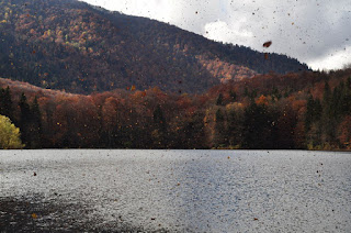
Posts

Komarnica Canyon

Image
This relatively easy walk can be done in several variants, all of which will be detailed here, although this time I am recording the second walk along this canyon, not wishing to duplicate blogs on the same trail. The River Komarnica starts in Durmitor near Sedlo, flowing down this canyon – in the summer it is largely dry or else underground, whereas during the spring the flow is at its most powerful, and there are several waterfalls either along its course or from streams feeding into it as the descend into the canyon. The canyon is dominated on one side by a 15-km-long almost vertical wall of rock called Boljske grede, while on the other side the incline is gentler and almost completely covered in trees. The canyon widens out at the village of Komarnica, where there is road access. After several kilometres of dirt track, asphalt begins and the River Komarnica is joined by the River Grabovica which pours down one side of the canyon making a spectacular waterfall called S...

Trpezarija (from Zurim) 2,040m

Image
This ridge, the second parallel ridge going northwards after passing Zurim, has featured in many of my hikes this year. However, so far we have either gone eastwards along the top of the ridge, or perpendicular across it towards the next ridge (Mt Lola). This time we decided to go westwards along the top of the ridge towards Bijela and Krnovo. It took about two hours to get from the car parked by Zagaracki katun to the top of the ridge, then another hour or so to the highest point of the peak Trpezarija, not far from where the wind farm on Krnovo starts. It was not a tough walk, but we had to be careful because of the early sunset this late in the year. We wanted to see whether there was a quick route down from the ridge to the valley bottom, but not finding one along the way, we had to return the way we came.

Sljeme on one of the shortest days

Image
More just for the exercise than anything else, we decided to head over to Durmitor and enjoy the view from the top over all of Durmitor National Park. We needed crampons near the top, as the peak was covered in ice and packed snow. We tried exploring the minor peaks between Sljeme and Bandijerna, but decided that we would be hard-pressed for time and so headed down. The descent took a little longer than we had bargained for, and ended up seeing the sun set as we came down and returned to the car with hardly any light left.

Veliki Zurim in fog

We set out on a cloudy day, hoping that the road would not be covered in snow or ice, and we were fortunately able to get to the katun at the foot of Mali Zurim. A view from Borovnik a week earlier had revealed another way up Veliki Zurim, and it was decided to explore this, even though the entire mountain was engulfed in low cloud and we could not see where our path was taking us to. When we found an animal trail, we followed it up a snaking route to a pass, but given the limited visibility, headed straight up to where we knew the summit to be, which was marked by a canister containing a log book and pen. The way down was potentially dangerous, given that we could not see that far in front, but I trusted to my memory of climbing it before, and we managed to descend without problem, if a little tentatively.

Mt Borovnik (from Zurim side)

Image
Ice on the road to Zagoricki katun prevented us from driving up to the foot of Zurim, so we decided to head towards Borovnik, which I still have not climbed right to the top. There was some snow on the ground and the rivulets that crisscross the Lukavica valley were apparently in full flow. We had to cross on stepping stones on many occasions, until unexpectedly we came to a beautiful hidden waterfall. I managed to divine a way up this side of Borovnik, up a grassy strip cutting through boulders and pine trees. This side was relatively free of snow, facing towards the sun, but once we got to the top, there was enough snow to hide the crevasses and cracks in the rock, and made traversing the top ridge quite hazardous. But the weather was excellent and the descent was relatively danger-free. Borovnik is a wide massif, and the three times I have tried to climb it, there has not been enough time to get from the foot right to the summit

Autumn walk in the (national) park - Biogradska gora

Image
This is not strictly a hike, more like a long drive and mini-walk. But autumn in this national park is spectacular because of the diversity of trees and the colours of the leaves. Every day gives you a different combination of sunlight, clouds and foliage, and I was on this occasion treated to strong winds which suddenly blew a cloud of leaves over the lake, as if caught in a locust swarm. The entrance fee to the national park is €3 and it is accessible from the main Podgorica-Bijelo Polje road, north of Kolasin. Construction is ongoing on a restaurant (if was ongoing last year at the same time) by the lake, and the souvenir shop was closed

Bandijerna Peak (2,409m)

Image
Four weeks after the last attempt was thwarted by rain, I finally returned to this peak, close to Durmitor's highest (Bobotov kuk) and right in between the jagged edge of Zupci and Sljeme. Despite being higher than Prutas, the walk to this peak is relatively short from the parking area at Sedlo, on the Virak-Trsa road. There was still snow on the north-facing and shaded spots, but nothing too concerning. The path was very muddy and slippery from the thawing snow, but once we got off the path onto the rocks the going was easier. There is no marked path except the path to Zeleni Vir and Bobotov kuk, but, as visibility was good this time, we were able to veer off and head towards Trojni prevoj (Three-way Pass). It seems there are piled stones on some of the rocks to indicate roughly the right way, but it was no problem just heading towards where I knew we had to go. From Trojni prevoj we headed straight up the mountain from where we were rewarded with a beautiful 360 degr...